
Walk a Grand Chute Street
A sound street directory search separates ownership from occupancy. Outagamie County tax records can identify the owner tied to a parcel, while a deed can document a transfer. Neither proves who sleeps at the address today. A voter match or dated directory entry adds a different kind of evidence. Work in that order so one weak name match does not become an unsupported claim about a Grand Chute household.
- Enter the street number and name in Ascent. Omit the directional and suffix, then open the red parcel-number result.
- Check the polygon in county GIS. Record the parcel ID, physical site, adjoining lots, and legal description.
- Use MyVote only for a specific person or address. A street-wide electoral file follows the separate Badger Voters route.
- Carry the owner name and legal description into LandShark. Link deeds by document number, party role, date, and land.
- For a past snapshot, inspect historical street pages and confirm the scan instead of trusting OCR alone.
This chain can show a documented owner, a registered voter, or a named historical occupant. Those labels are not interchangeable. Log the source date beside every name because tax rolls, voter status, deeds, and directory volumes update on different schedules.
Search Grand Chute by Address
Outagamie County Ascent Land Records offers three routes: parcel number, street address, or owner name. The interface expects one route at a time. A street search needs both number and name, with no directional or suffix. A parcel search omits spaces and dashes. The red parcel-number result opens the tax and property detail.
| Ascent field | Input | Street use | Limit |
|---|---|---|---|
| Parcel number | Text | Open one known lot | Remove spaces and dashes |
| Street number | Number | Pair with street name | No whole-street button was found |
| Street name | Text | Find the physical site | Omit direction and suffix |
| First and last name | Text | Check a known owner | Both name fields are used |
| Red parcel number | Result link | Open tax detail | An owner is not a resident roll |
The live Ascent screen shows that official starting point.
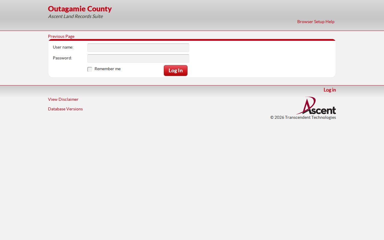
Each number must be opened as its own parcel result when building a Grand Chute by-street record trail.
Read Grand Chute Parcel Results
A parcel detail may supply the parcel ID, owner, physical location, mailing destination, legal description, values, taxes, credits, and tax bill. Save the parcel ID first. It is the county join when a street number is incomplete or an older deed uses lot, block, certified survey map, or metes-and-bounds language.
- Parcel
- A mapped unit of land identified for tax and record purposes.
- Situs address
- The physical location of the land or improvement.
- Plat
- A recorded map showing lots, blocks, roads, and legal geometry.
- Criss-cross directory
- A historical directory arranged by street and number rather than surname.
A mailing address is where a tax notice goes. It may be outside town, a business, or a care-of destination. Do not turn it into proof that the owner lives there. An Appleton city line can also serve a physical Grand Chute site.
Note: Current-year rolls post after the tax year, so record the roll year before treating an owner name as current.
Map Grand Chute Street Parcels
County GIS defines which polygons touch the street. The owner-view parcel service supports identify, query, find, and export. Its companion open-data layer exposes owner-associated parcel geometry. Road medians, broad commercial lots, and irregular boundaries mean the next mailing number may not be the next physical parcel.
The CountyTaxParcel feature layer makes that structure visible.
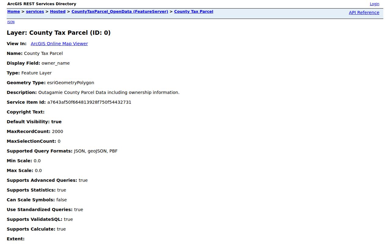
Save adjoining parcel IDs, then open each in Ascent instead of assuming visual closeness proves a shared address or household.
County layers can add zoning, flood, PLSS survey, historic aerial, foreclosure, or LiDAR context when available. These describe land and boundaries. They do not identify everyone at a site.
For a full named street, keep a log with the entered address, parcel number, physical site, tax mailing destination, current roll year, deed number, and confidence. The county service can export mapped features, but its maximum selection or record count is 2,000. A map export still needs a check in Ascent because a layer label may be less current than the tax detail. Historic aerials can explain a road shift or a later lot split, while PLSS and plat layers connect a modern parcel to older survey language.
Grand Chute Assigns Addresses
Outagamie County uses an emergency grid that begins in the southeast and extends north and west. The county describes about 400 address positions per mile, one every 13.2 feet. Yet Grand Chute is a named exception to the county's usual assignment process for unincorporated areas. Property owners seeking a new local number must contact the town.
This split matters in a street directory. County Real Property Listing still maintains parcel maps, legal descriptions, and tax records. Town Community Development handles local addresses and provides hard-copy street, plat, utility, as-built, and district-plan materials at Town Hall. No verified townwide renumbering date was found, so bridge old numbers through plats and land descriptions.
Real Property Listing names Terri Lison at 920-832-5665 for addressing and property-listing questions, while GIS specialist Brock Van Deurzen is listed at 920-832-2036. Those county contacts help with the parcel side. The town remains the right office for assignment inside Grand Chute. A number that fits the county emergency grid does not settle which municipality assigned it.
The Grand Chute GIS and property page shows the town route.
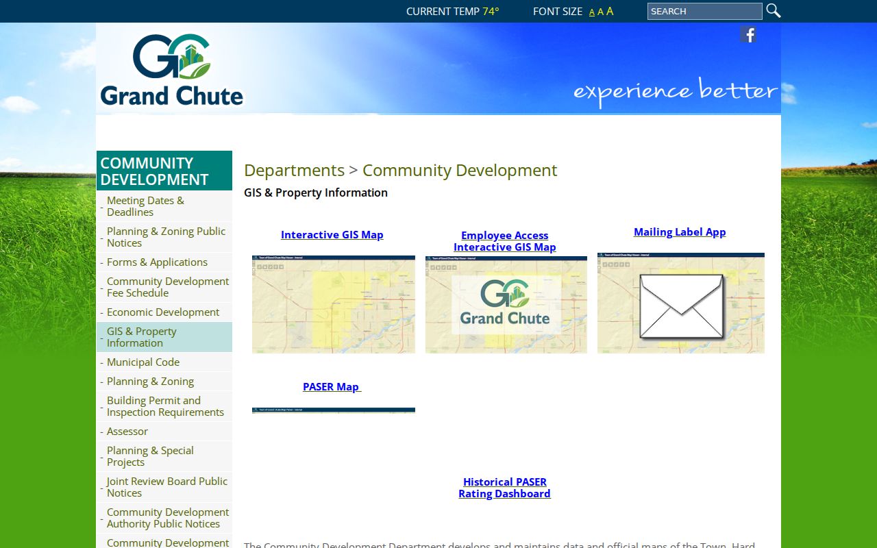
The town page is the fallback when county maps do not settle an address, plat, or plan question.
Grand Chute Street Record Sources
No official source is a full household list. Each system contributes a narrow fact, so a reliable street directory result states which source produced the name and what it proves.
| Address source | Keeper | Street evidence | Access |
|---|---|---|---|
| Property and tax roll | Outagamie Real Property Listing | Parcel, owner, situs, mailing and tax detail | Free Ascent search |
| GIS parcel map | County and town | Geometry, adjacency and map layers | Web service or map request |
| Recorded deeds | Register of Deeds | Named parties, transfer and land description | Free index; paid images or office |
| Voter records | Wisconsin Elections Commission | One registration or ordered file fields | MyVote or Badger Voters |
| Permits and code files | Town custodian | Address-linked public material | Defined records request |
| Historical street pages | Library and digital collections | Dated person, firm, or institution | Scan, microfilm, or staff help |
When a portal fails, keep moving through the documented channels. Town and county custodians accept focused requests; the Register of Deeds holds office records and older books; Community Development supplies maps; library staff can help with microfilm.
Link Grand Chute Deeds
Carry the parcel legal description to Outagamie County LandShark. Search the current owner as grantee, the party receiving land, to find an acquisition deed. The seller is the grantor. Search that seller as an earlier grantee and repeat only while the legal description continues to match.
The LandShark landing page provides the recorded-document route.
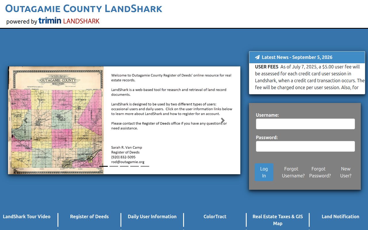
Log document numbers and dates. Index searching is free, while images and copies carry charges. A current notice says a credit-card session with a transaction has a $5 user fee, plus a 5 percent convenience charge for credit-card escrow replenishment.
Index caution. LandShark says its index is not a title search, and the 1979 through 1989 back-index is not accuracy-confirmed. Check ColorTract, tract books, or office records before deciding a deed does not exist.
Check Grand Chute Voter Context
MyVote Wisconsin accepts first name, last name, and birth date, or street address, unit, city, and ZIP. It returns registration and election context, districts, and participation history, never ballot choices. Absence does not identify nonvoters, children, renters, or protected people.
The MyVote search shows its two paths.
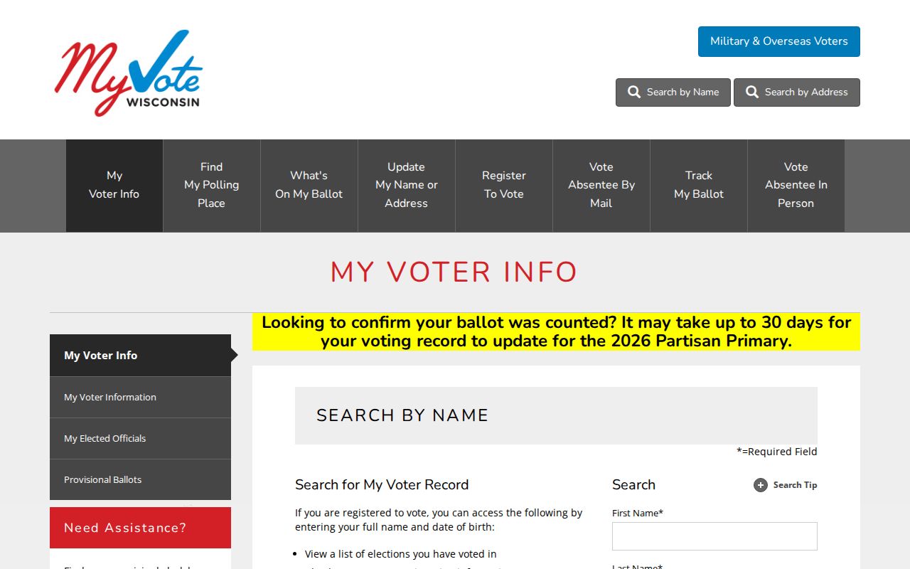
This supports narrow confirmation, not a whole-street export. Broader electoral data comes from Badger Voters.
Badger Voters documentation explains the file and exclusions.
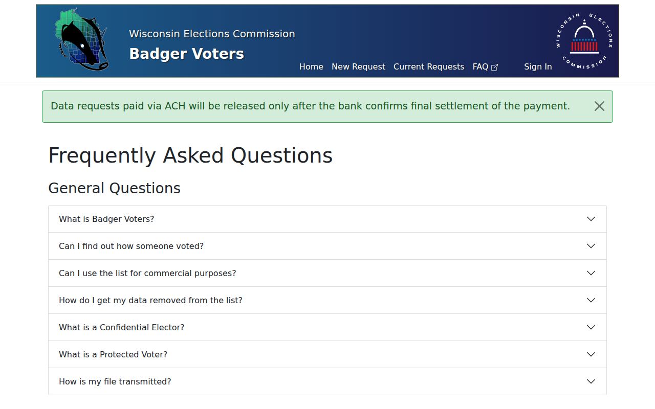
The file can include participation back to 2006, but excludes birth dates, Social Security numbers, party preference, ballot choice, and protected voters. Its base cost is $25 plus $5 per 1,000 records, with a six-month download period.
Read Old Grand Chute Streets
The 1901 Bunn & Ferry Appleton city and telephone directory includes Grand Chute and has both alphabetical and street sections. A historical street directory line may name a person, firm, institution, or rooming place. It is a dated clue, not proof of a present household.
Search initials, spouse names, widow notes, occupations, and OCR variants, then inspect the scan. The full collection and entry keys belong to the Grand Chute city directories. Here, connect an old street line to a parcel, plat, or newspaper date.
Appleton Public Library provides directories, yearbooks, Sanborn maps, plat maps, and newspaper microfilm back to 1853. Its obituary index and article route can bridge an address to a death, family event, or property notice.
Note: No complete printed run or verified Grand Chute renumbering year was found, so never treat a missing volume as proof of absence.
Request Grand Chute Address Files
No public townwide permit or code lookup was located. Use the Grand Chute open-records process for a defined property, record type, and time span. The form asks for a clear description, preferred format, and contact details, though Wisconsin law does not always require identification.
The town allows inspection, electronic delivery, mail, and pickup. It lists 25 cents per black-and-white page, 50 cents per color page, actual media or postage, and location costs when those costs reach $50. Prepayment may apply at $5. Police files go to that department; other materials begin with the clerk or named custodian.
A useful request names the street number, road name, parcel ID if known, date range, and one record class, such as a permit, code case, plat, or as-built plan. Ask for electronic copies when practical. The custodian can explain who holds a file and what it costs, but cannot release protected content just because an address was supplied. Wisconsin Public Records Law, Wis. Stat. §§19.31 through 19.39, provides the access framework.
Ask staff to separate releasable parts and cite the basis for a denial. A narrow request is more useful than asking for every record on a street.
Grand Chute Street Directory Limits
Public land records do not reveal a complete household. They can omit renters, children, guests, residents who do not own land, and protected people. No public Grand Chute utility hookup list, school-zone resident directory, or official neighborhood roster was found. DMV-derived names, phone numbers, residence addresses, and ZIP data also have specific Wisconsin protection.
Safe at Home can supply a substitute legal address to people facing serious threats. Confidential electors may keep actual address information out of public voter records. A blank result may reflect lawful protection.
Lawful use. Use Grand Chute address records only for lawful personal research. Never use a name, map, or address to stalk, harass, threaten, or expose a protected person.
A careful street directory labels each result as owner, recorded party, voter record, or historical entry. It does not publish a speculative household list.